
The Faculty of Engineering and Green Technology (FEGT) and Japan’s Public Works Research Institute (PWRI) collaborated on a project to understand the nature of the sediment transport as well as to find the management methods and its sediment in the lower Perak River.
Kickstarting the project was a survey conducted at Perak River from 14 July to 18 July 2019 by a team comprising UTAR’s researchers and postgraduate students, experts from PWRI, Fukuda Hydrology Center Co. Ltd, Yasuda Sokuryo Co. Ltd, the local authorities as well as a professional body. They included FEGT academics Prof Dr Akihiko Nakayama, Ir Dr Chan Cheong Loong, Dr Wai Soon Han; PWRI representatives Dr Atsuhiro Yorozuya and Takeshi Shimizu; Fukuda Hydrology Center Co. Ltd representatives Koichi Tsuchida and Noriyuki Nishiyama; Yasuda Sokuryo Co. Ltd representative Teruaki Yasuda; Pengarah Mohidi Mohammad and Penolong Pengarah Salfarina binti Mohd Sharif from Jabatan Pengarian dan Surian (JPS); Chairman of The Institution of Engineers Malaysia (IEM) Simon Yeong Chin Chow and Bachelor of Engineering (Hons) Environmental Engineering students Wendy Loh Ring Yi, Khoo Jing Sheng, Koh Boon Jin and Loh Xiang Ru.
“The Perak River basin is the second largest in Malaysia with a series of dams in the upstream reaches for power generation which constitute a large fraction of hydropower in Malaysia. They are used for flood control as well as supplying water. The sediment loads of this river and its tributary Kinta River are very high especially the fine sand and silt particles from the limestone of the basin geography washed down by frequent heavy rainfalls. The downstream reaches are influenced strongly by the sediment transported from upstream. This influences the bank stability during floods and navigation passages during low waters. Frequent dredging around the meandering passages near Teluk Intan is one of the problems,” explained Prof Nakayama.
The team conducted a numerical simulation of the flow in the area with bathymetric data supplied by the Department of Irrigation and Drainage which shows the strong effects of the sharp bends in the Teluk Intan area. A separate study of satellite images by Yorozuya and International Centre for Water Hazard and Risk Management under the auspices of UNESCO (ICHARM) indicates that there is a special feature for the confluence and meander downstream of Tanjung Tualang. The collaboration with ICHARM has also assisted the team in finding methods to solve the problems of Perak River and contributed to advancing the fundamental knowledge of sediment loaded river flow in winding river reach on low land.
The team also noted that recent advanced methods of measuring river flow and sediment motion and concentration such as Acoustic Doppler Current Profiler (ADCP) and image processing are available and may be used to obtain basic data in Perak River as well. Therefore, preliminary visits to the lower reaches of Sungai Perak from the confluence of Kinta River through bends in Teluk Intan and to the river mouth of Bagan Datoh by car and by boat have been made.
The survey at Perak River was conducted using ADCP to obtain the flow velocity and sediment concentration distributions in the Perak River from Sungai Bidor confluence around the city of Teluk Intan (map shown below). An ADCP was mounted on a JPS small boat and it traversed the river for three days. The water samples were taken while the ADCP traverse was conducted. The flow-field/turbidity on the water surface was taken by a video camera and a multi-spectrum camera mounted on a UAV (Unmanned Aerial Vehicle). One of the outcomes from the survey was providing basic knowledge about flow and sediment in the Perak River to appropriate government agencies, and the scientific aspects will be published in technical writings.
“It was an interesting survey because I was able to witness the gap between the high tide and the low tide, and I was able to use the equipment. From the survey, I learnt that water samplings must be taken in different depth for each sampling point. It was certainly an educational survey. It will be useful for my future career if I were to explore the environmental consultancy field,” commented Loh.
Echoing Loh’s sentiments on the usefulness of the knowledge for a future career, Khoo mentioned that the survey was a rare opportunity for students to be working with experts from overseas. “Surveying the river was great because the Perak River is one of a kind. The way and reason behind its strange behaviour are not well understood and with that survey, we will be able to find answers,” said Khoo.
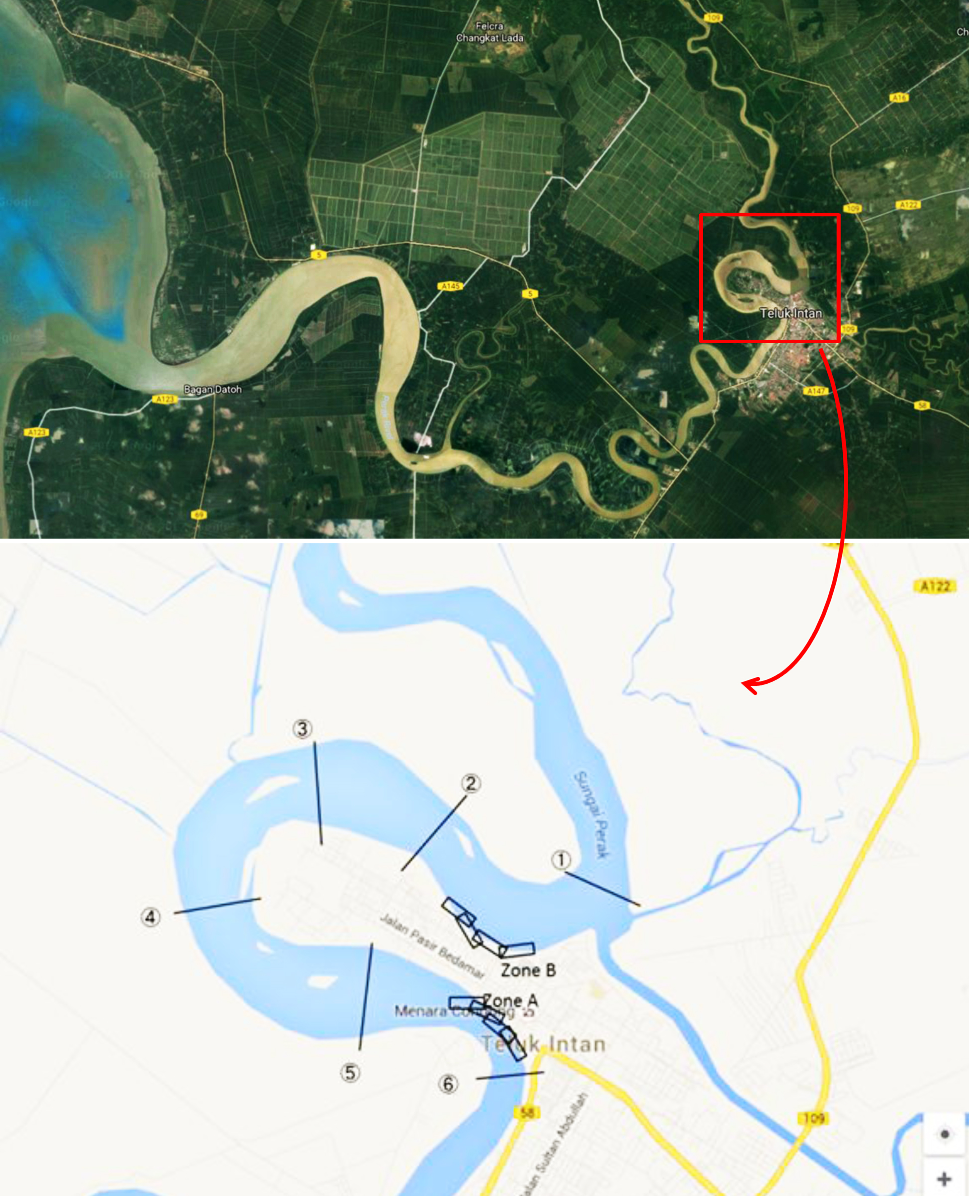
Map of the survey area
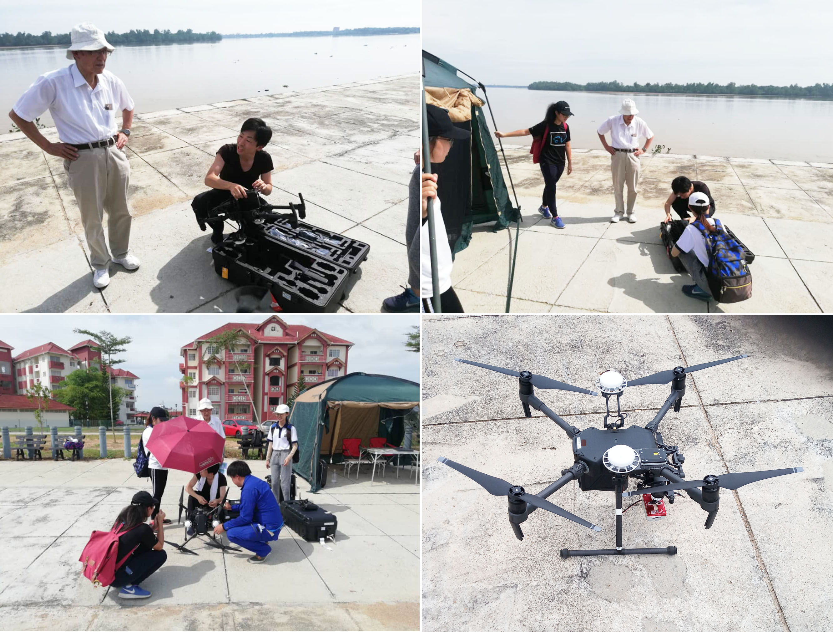
The team setting up the drone
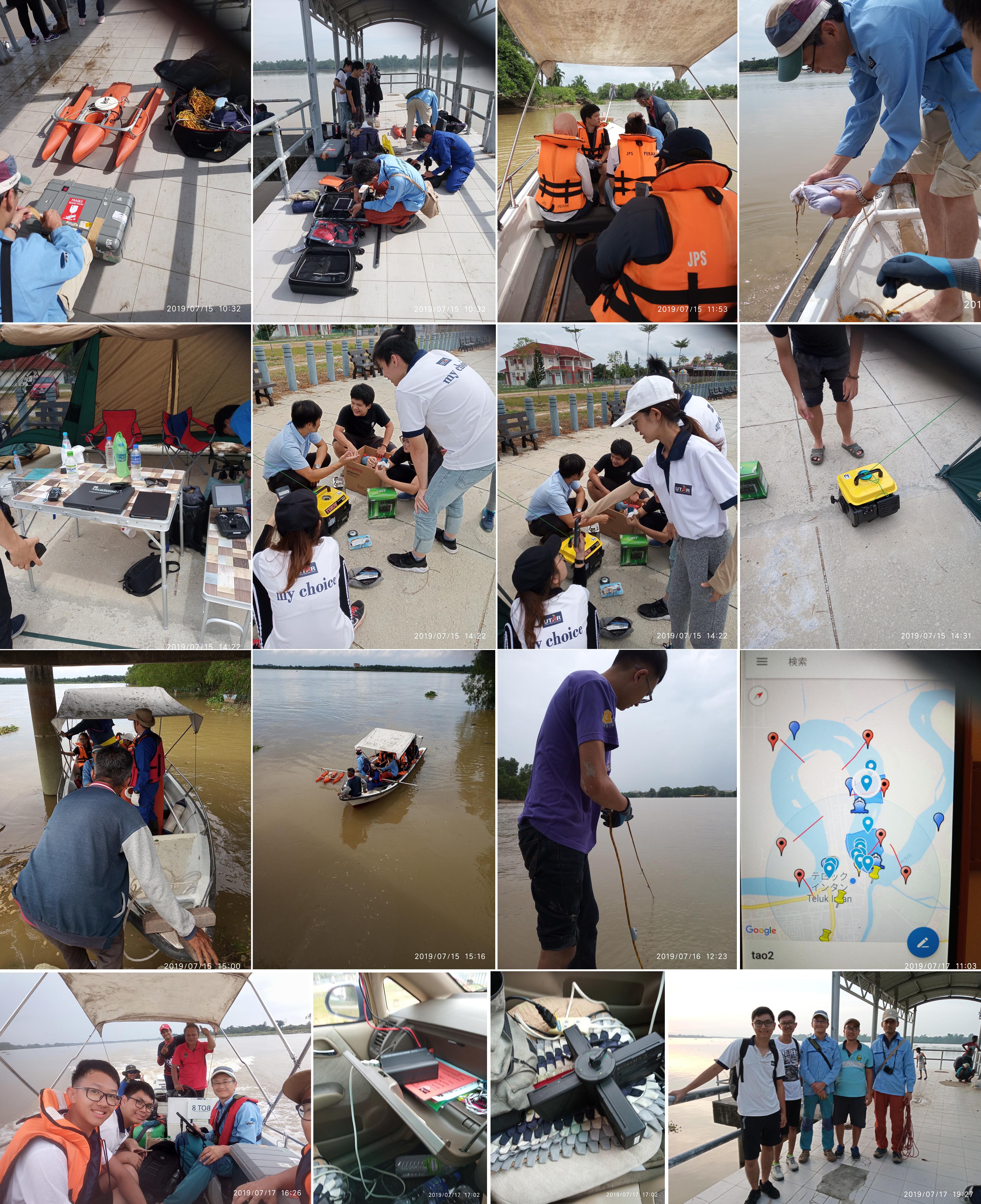
The team conducting their survey at Perak River
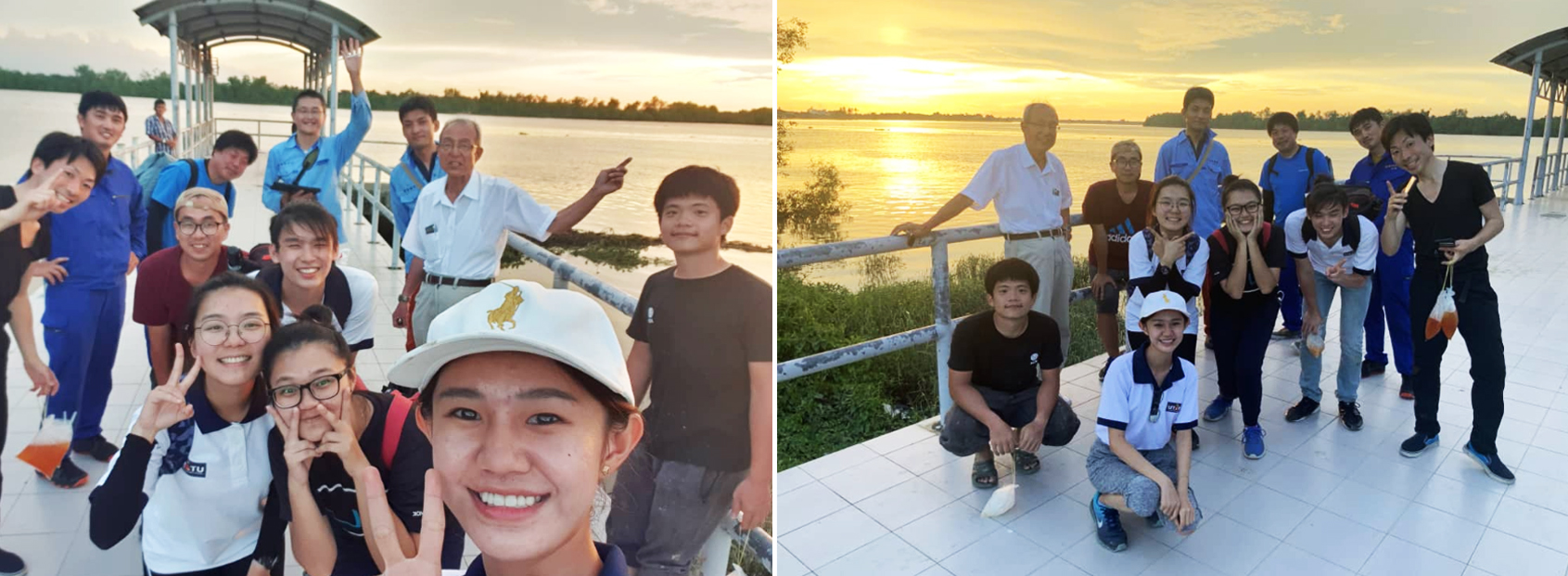
Ending the survey with big smiles
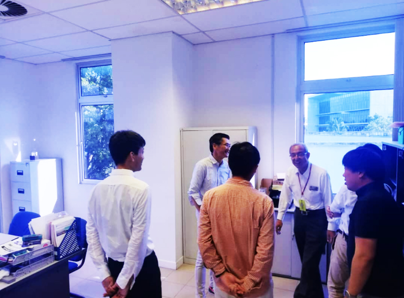
The briefing session at FEGT
© 2019 UNIVERSITI TUNKU ABDUL RAHMAN DU012(A).
Wholly owned by UTAR Education Foundation Co. No. 578227-M LEGAL STATEMENT TERM OF USAGE PRIVACY NOTICE